
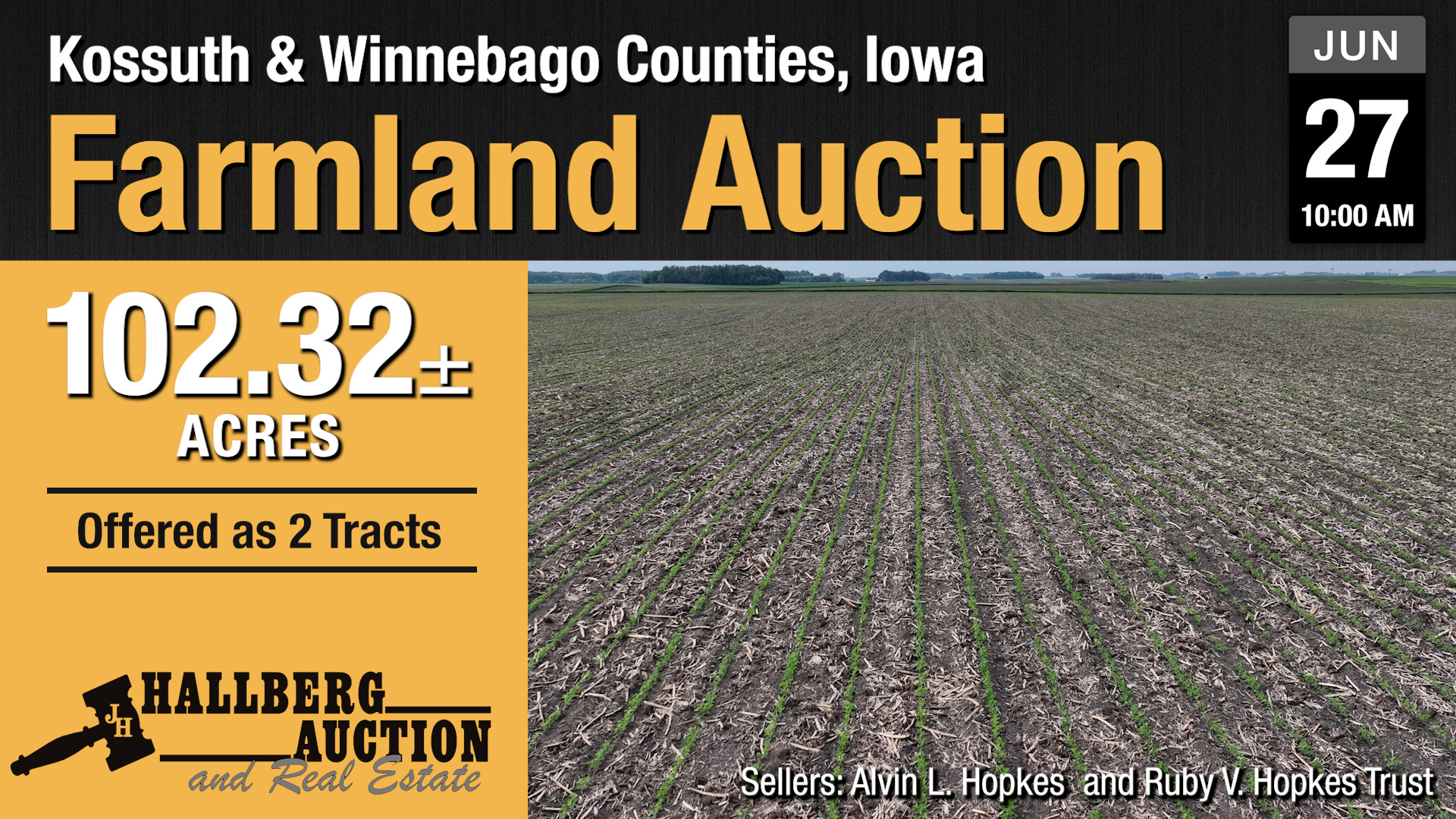
Parcel One: 62.32 Acres +/- in Kossuth County IA.
Location: Approximately Three and a half miles North of Titonka, Iowa laying along 210th Ave.
Legal Description: All that part of the Northwest Quarter (NW ¼) lying west of the Drainage Ditch in Section Twenty-one (21), Township Ninety-eight (98) North, Range Twenty-seven (27), West of the 5th P.M., Kossuth County, Iowa, EXCEPT A tract of Land shown on a survey recorded on October 27, 1982, in Book 6 of Land Plats at Page 81 in the Office of the Recorder for Kossuth County, Iowa, and SUBJECT TO Mineral Reservations of record.
This Parcel contains 58.560 taxable acres and 56.73 Cropland acres according to the FSA. It boasts a CSR 2 of 82.5 with primary soils of Canisteo, Nicollet, and Clarion Loam. The Farm has a Corn Base of 30.60 Acres with a PLC Yield of 162, and a Soybean Base of 26.10 Acres with a PLC Yield of 47.
Parcel Numbers: 12-21-100-006; and 12-21-100-011
Current Year Property Tax Estimate: $2,237.85
Sold for $15,500/acre
Parcel Two: 40 Acres +/- in Winnebago County IA.
Location: Farm lays along 360th St (County Road A42) and 20th Ave. This is approximately Three Miles North and Five Miles East of Titonka, Iowa, or Seven Miles South of Buffalo Center, Iowa.
Legal Description: The Northwest Quarter (NW ¼) of the Northwest Quarter (NW ¼) of Section Twenty-eight (28), Township Ninety-eight (98) North, Range Twenty-Six (26), West of the 5th P.M., Winnebago County, Iowa.
This parcel contains 37.21 Taxable Acres and 37.45 Cropland Acres according to the FSA. It has a 70.7 CSR 2 with primary soils of Okoboji, Harps, Canisteo, and Clarion types. The Farm has a Corn Base of 23.35 Acres with a PLC Yield of 176, and a Soybean Base of 11.5 with a PLC Yield of 49.
Parcel Number: 0928100001
Current Taxes: $1080.00
Method of Sale: Purchase Price of each parcel will be the bid amount times the multiplier. Parcel One will have a multiplier of 58 and Parcel Two will have a multiplier of 37.
Sold for $18,600/acre
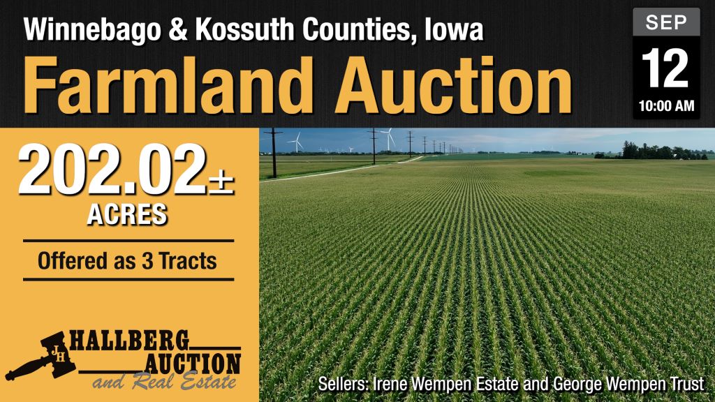
Parcel One: 87 Acres +/- in Kossuth County IA.
Location: Approximately Two Miles West and 2 ½ Miles North of Buffalo Center, Iowa laying along 240th Ave.
Short Legal Description: The NW NE of Section 2, Township 99, Range 27, and The NE NE of Section 2, Township 99, Range 27 except parcel 2 as described by survey doc #2023/1856
Parcel One and Parcel Two are currently farmed together. They currently together consist of 123.62 Cropland Acres according to the FSA. If they are purchased separately this parcel is expected to contain approximately 83.895 Tillable Acres. This number has been determined by using the current FSA cropland number less the tillable acres of Parcel Two (38.3 According to Surety Mapping) also less the net acreage of what has been surveyed off north of the building site (1.425). The two parcels together have a Corn Base of 123.60 acres with a PLC Yield of 146. This parcel receives a wind easement payment of $25 per acre, which adjusts 2.5% per year until 2055. This parcel also receives a payment from Alliant of $19,500 until 2058.
This Parcel will contain approximately 84.22 net taxable acres (after deducting new surveyed parcel). The current CSR2 according to the county is 83.1 (Note this includes 7.93 acres removed by new survey). The primary soil types are Nicollet, Canisteo, Webster, and Okoboji Clay Loams.
Parcel Numbers: 08-02-200-001; and 08-02-200-007 (less additional area removed by survey)
Current Year Property Tax Estimate: $3,358.10 (includes area removed by survey)
Sold for $16,200/acre
Parcel Two: 40 Acres +/- in Kossuth County IA.
Location: Approximately Two Miles West and 2 ½ Miles North of Buffalo Center, Iowa laying along 240th Ave.
Short Legal Description: The SE NE of Section 2, Township 99, Range 27 less that part of parcel 2 as described by survey doc #2023/1856 which extends into the SE NE.
This farm consists of 38.77 net acres according to Kossuth County. It is currently being farmed with Parcel One. The current CSR2 according to Kossuth County is 85.9. If this parcel is purchased separately it is expected to have approximately 38.3 tillable acres (Number Generated by Surety Mapping). This parcel receives a wind easement payment of $25 per acre, which adjusts 2.5% per year until 2055.
Note: If this parcel is not purchased by the same buyer as Parcel One, then the buyer shall be responsible for the creation of any necessary field drive.
Parcel Number: 08-02-200-004
Current Taxes: $1460.80
Sold for $16,500/acre
Parcel Three: 95.02 Acres +/- in Winnebago County IA
Location: From Buffalo Center the farm sits approximately one mile east and three miles north. It upon 20th Ave and 460th St.
Short Legal Description: NE FR NW Fr and NW NW of Section4, Township 99, Range 26.
This farm is 86.06 net taxable acres according to Winnebago County. The FSA lists 91.74 Farm Land Acres and 87.97 Cropland Acres with a Corn Base of 87.81 acres and a PLC Yield of 143. It has a CSR2 of 78.6 according to Surety Mapping. It’s primary soil types are Canisteo, Clarion-Swan Lake, Okoboji, and Clarion Storden. This parcel receives a wind easement payment of $25 per acre, which adjusts 2.5% per year until 2055.
Sold for $12,500/acre
Method of Sale for Parcel One and Two: Purchase Price of each parcel will be the bid amount times the multiplier. Parcel One will have a multiplier of 84 and Parcel Two will have a multiplier of 39. These two parcels will be sold by the buyer’s choice method. The high bidder will have the option of taking either parcel or both for the bid amount times the multiplier. If the high bidder does not take both parcels, then the next will be offered. Method for Parcel Three: This parcel will be offered for the bid amount times the multiplier. The multiplier for parcel three will be 86.
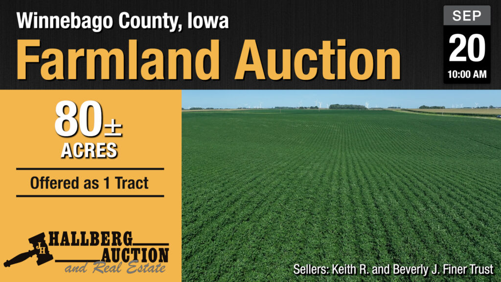
80 Acres +/- in Winnebago County IA.
Location: Farm lays north of 380th St. and west of 70th Ave. It is approximately five miles south and five miles east of Buffalo Center or four miles south and two and one half miles west of Thompson.
Short Legal Description: the SW SE and SE SE of 7-98-25 Winnebago County
This Parcel contains 77 taxable acres and 75.06 Cropland acres according to the FSA. It boasts a CSR 2 of 85.2 with primary soils of Clarion, Webster, and Nicollet. The Farm has a Corn Base of 58.8 Acres with a PLC Yield of 184, and a Soybean Base of 16.26 Acres with a PLC Yield of 47.
Parcel Numbers: 1007400003; and 1007400004
Current Year Property Tax: $3070.00
Method of Sale: Purchase Price will be the bid amount times the multiplier. The multiplier will be 77.
Sold for $15,800/acre
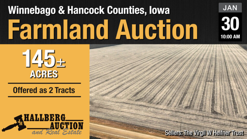
Parcel One: 70 Acres +/- in Winnebago County IA.
Location: Approximately seven miles south and one mile east of Buffalo Center, or one mile west and three and a half miles north of Woden.
Short Legal Description: The S ½ OF SW Section 21, Range 98, Township 26 Less 250’ of the W 600’ of the SW SW and also less Parcel “E” as described by plat or survey doc #2021-0877
The NW NE of Section 2, Township 99, Range 27, and The NE NE of Section 2, Township 99, Range 27 except parcel 2 as described by survey doc #2023/1856
Parcel One consists of 70.67 Cropland Acres according to the FSA, (this appears to include a small amount of land that belongs with the acreage that has been removed from the property). According to Surety Mapping the parcel has a CSR2 of 85.2 (includes very small area that has been removed from the property). The parcel has a Corn Base of 44.06 acres with a PLC Yield of 176 and a Soybean Base of 21.71 acres with a PLC Yield of 49.
This Parcel contains 67.58 net taxable acres according to Winnebago County.
The primary soil types are Canisteo, Nicollet, and Webster Clay Loams, and Clarion Loams.
Parcel Numbers: 0921300002, 0921300005, and 0921300008
Current Year Property Tax Estimate: $2722.00
Sold for $15,800/Acre
Parcel Two: 75 Acres +/- in Hancock County IA.
Location: Approximately two miles south and two and a half miles west of Woden.
Short Legal Description: W ½ of NW Section 30, Range 97, Township 26
This farm consists of 75.19 net acres according to Hancock County. It has a CSR2 of 81.6 according to Surety Mapping. According to the FSA there are 75.09 acres of Cropland. The parcel has a Corn Base of 37.59 acres with a PLC Yield of 173 and a Soybean Base of 37.50 acres with a PLC Yield of 50.
Parcel Numbers: 0430226000 and 0430251000
Current Net Taxes: $1994.00
Sold for $15,200/Acre
Method of Sale: Purchase Price of each parcel will be the bid amount times the multiplier. Parcel One will have a multiplier of 67.5 and Parcel Two will have a multiplier of 75. Parcel One will be offered first and Parcel Two immediately after.